Panorama Point Sublime 1Panorama Point Sublime 1
©Panorama Point Sublime 1
SpacesWorld-renowned

Unesco World Heritage

Unesco Causses Cevennes Meyrueis 1Unesco Causses Cevennes Meyrueis 1
©Unesco Causses Cevennes Meyrueis 1

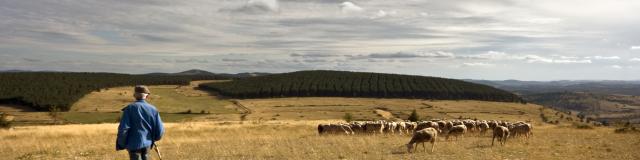
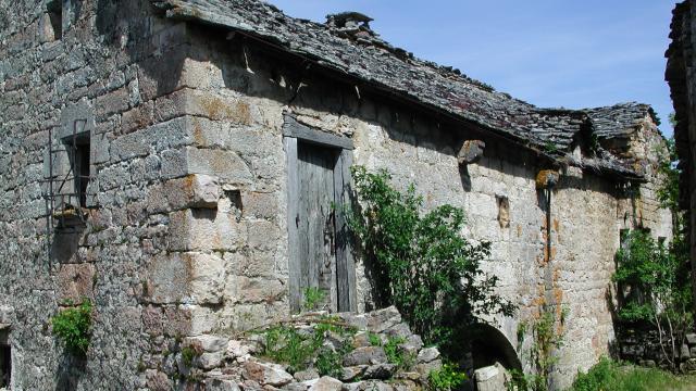
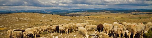
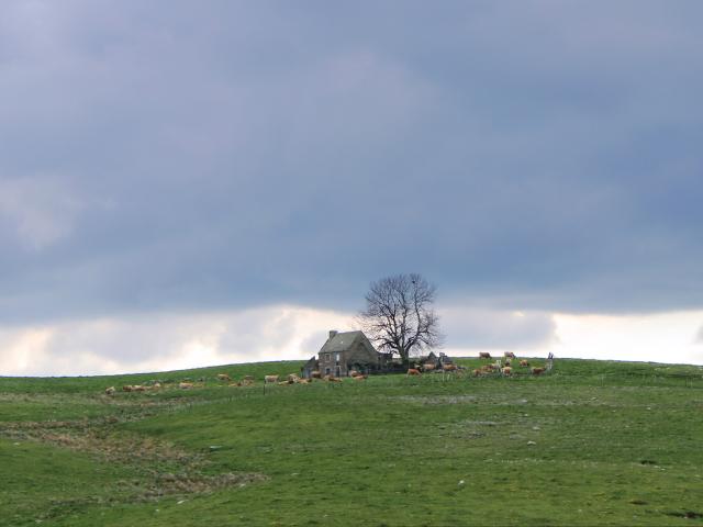
Since 2011, the Causses and Cévennes region has been on UNESCO’s World Heritage List as a cultural landscape of Mediterranean agro-pastoralism.

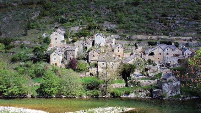
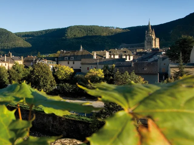
The listed site covers 3,000 km² from the southern Massif Central to the Mediterranean. It is divided between the departments of Gard, Lozère, Hérault and Aveyron. However, it does not cover all the Causses or all the Cévennes.

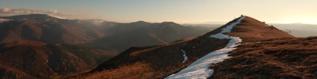
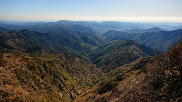
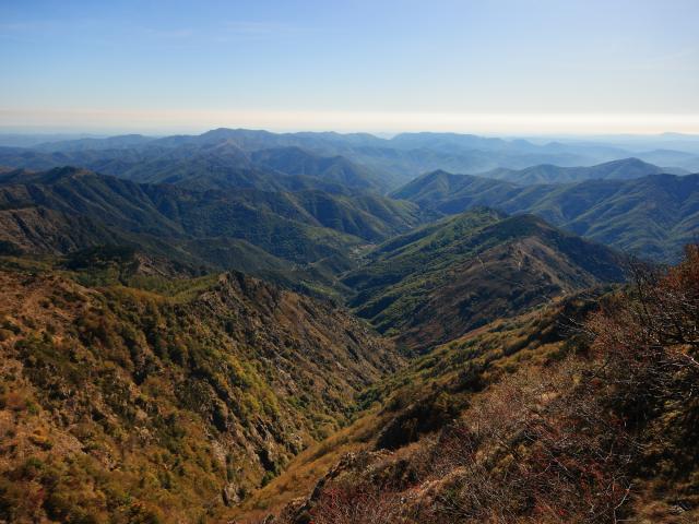
A mountain landscape criss-crossed by numerous valleys, it is representative of the relationship between agro-pastoral systems and their physical environment.

Landscapes

The Causses and Cévennes offer a wide variety of natural environments in a small area.
This phenomenon, known as ” ecological compression “, can be explained by the physical characteristics of the area: differences in altitude (from a height of 200 to 1,700 metres in less than 40 kilometres from the Languedoc plain), differences in soil types (schist, granite, limestone, themselves sculpted by intense erosion, which multiplies the ecological niches), contrasts in climatic zones (Mediterranean, oceanic, continental) and slopes (ubacs, adrets), which are particularly sensitive in the Cévennes valleys.

The result is a diversity and richness of environments, flora and fauna that are reflected in the many protected natural heritage areas that cover the region. Around 2,200 species of flora have been recorded in the Cévennes Biosphere Reserve, representing 40% of the French flora in just 0.5% of the national territory.

This diversity and richness are amplified by the agro-pastoral imprint on the entire perimeter of the site, and above all by the resulting openness of the land:

  • Large areas of steppe-like grassland on the karstic plateaux of the Causses, the largest in Europe, with an original flora and fauna; with occasional cultivation of the dolines;
  • high altitude grasslands, moors, peat bogs and wetlands on the granite domes of the high Cévennes;
  • edge effects created by the interpenetration of wooded and open areas, so important for biodiversity.

Two territories

with its intertwined history

Over the centuries, the presence of man and his herds on the Causses has led to successive periods of deforestation and afforestation.
These major transformations, linked to variations in human activity, have successively transformed the image of this territory.
The forest cover was exploited in prehistoric times to open up areas for livestock farming, then in Roman times to produce pitch from pine resin and to supply wood for the ovens needed to produce the sigillated vases that were distributed throughout the empire.
The forest cover of the Causses, mainly made up of a vast oak grove, was further cleared during the rural development work carried out by monastic, military and religious orders in the 12th and 13th centuries, which reached its peak in the 18th century.

In the Cévennes, until then a land of mixed subsistence farming, the chestnut tree developed from the twelfth and thirteenth centuries onwards, in response to the need to find a supplementary crop given the poor yields of cereals on the siliceous soils.
The expansion of the chestnut grove in the modern era, which was partly rivalled in the early 18th century by the mulberry tree linked to sericulture, had a lasting impact on the rural landscape, giving it an identity that endures to this day.

The heyday :

The end of the 18th century and the first part of the 19th century were a period of prosperity for the Causses and the Cévennes.
Sericulture developed in the Cévennes valleys, thanks to large mulberry tree plantations, while chestnut groves were restored and extended.
New buildings were added to the built landscape: silkworm nurseries and spinning mills. The former housed silkworm farms fed on the leaves of the mulberry trees. The latter, built at the bottom of the valley near the water, produced silk for sale.
In the lower Cévennes, the exploitation of the subsoil brought additional activity.
The silver-lead mines at Vialas, and above all the coal-mining furrow at Alès-La-Grand’Combe, attracted men from the eastern edge of the region, who became miners while remaining farmers.

The Causses also experienced strong economic and demographic growth: the population of the Causses doubled between 1780 and 1810, reaching its peak with a density of 20 inhabitants per km².
Farming techniques evolved. The dismemberment of the large religious or aristocratic estates during the French Revolution boosted the economic growth of the villages at the same time as construction increased and population density increased.
The abolition of aristocratic privileges led the new landowners to build mills (windmills on the causses and watermills in the valleys), ponds, canals and dovecotes, all of which had previously been the property of the lords.
From 1820 onwards, fodder crops were grown on artificial meadows, increasing yields.
Sheep numbers grew rapidly.
In Larzac alone, the number of head rose from 50,000 to 250,000.
The result was the gradual disappearance of small farms unable to withstand the competition from other producers, and the depletion of some of the resources of this poor land.

The collapse of the Cévennes in the 19th century:

The economic wealth of the Cévennes valleys, based on silkworm rearing, declined in the second half of the 19th century when pebrine, a silkworm disease, decimated the silkworm nurseries.
The ink disease attacked the chestnut trees at the same time.
The precious food resources they provided dwindled rapidly. More generally, the value of all agricultural products fell by 50-60% of their former value.
Between 1856 and 1914, the Lozère Cévennes lost 40% of its population, who emigrated to the major urban centres and nearby mines. The loss of human life during the First World War (1914-1918) exacerbated the demographic drain: 20% of men and 25% of women aged between 20 and 40 left the region to find work in the towns.

In the Causses, the demographic depression coincided with the collapse of wool prices after 1815.
Emigration, followed by the bloodletting of the First World War, halved the population of the Causses between 1836 and 1936.
The structure of farming changed, with the concentration of farms, the abandonment or reforestation of some estates (reforestation of the Aigoual in the 1875s) and the extension of transhumant herds from the south to the southern Causses.

As a result, pastoralism suffered something of a setback, although it did not disappear like sericulture, or even decline as sharply as castaneiculture.

At the same time, the widespread deterioration of the forest during the previous period, which was particularly worrying in view of the catastrophic floods and the erosion of soils deprived of their protective mantle, led to massive reforestation: a policy of Restoration ofMountainLand(RTM), carried out over more than half a century and supplemented by plantations, mainly of maritime pines, designed to meet the needs of the industrial basin.

Today, the maintenance of open landscapes and the biodiversity that characterises them through agro-pastoralism is an important issue that requires the consolidation of practices, know-how and the promotion of typical, quality products derived from these activities, which does not exclude the search for modernisation.

classified area

134 municipalities

Perimeter protection

97 municipalities

5 gateway towns

Alès, Ganges, Lodève, Mende and Millau

Don’t hesitate to visit
the Unesco site house in Florac
and discover all the secrets of this exceptional region:

23 ter, avenue Jean Monestier
48400 FLORAC.

Discover this site with a dedicated web documentary:

You can find all the information you need on the Entente Causses et Cévennes website: